How Chinese satellites have boosted Iran’s war effort
As American images went dark, Chinese alternatives filled the void
 April 23rd 2026
China has provedcareful in its support for Iranin recent weeks. On March 2nd its foreign ministry spokesperson said the American-Israeli strikes “violate international law”. In recent days Xi Jinping, the country’s leader, said he wanted the Strait of Hormuz open for vessels in a call with Saudi Arabia’s crown prince. American intelligence is reported to have warned that China is preparing to send shoulder-fired rockets, the sort that could hit helicopters and low-flying planes. Yet China has offered little by way of serious economic, diplomatic or military aid. Its more indirect, and perhaps more important, contribution comes from space.
Social media are awash with images of the Middle East taken by Chinese satellites and released by Chinese firms. This comes just as American firms have clamped down under pressure from the Trump administration, cutting off journalists, researchers and activists from a vital supply of open-source intelligence. The proliferation of Chinese images reflects progress in the scope and sophistication of the country’s Earth-observation capabilities. It marks the end of a Western monopoly on the most advanced images from space. But for open-source analysts, Chinese images are a warning as much as a rescue.
The war with Iran has offered a golden advertising opportunity to Chinese satellite firms. Bill Greer, a geospatial analyst who co-founded Commonspace, a non-profit satellite service, believes the Trump administration’s clampdown needlessly hands America’s competitors an advantage. “The US is just shooting our own commercial people in the foot to limit their access,” he argues, “when our adversaries can still get data through other systems.”
Evidence of collaboration between Chinese satellite firms and Iran has mounted in recent weeks. China Siwei, part of the state-owned China Aerospace Science and Technology Corporation, is known to have taken high-resolution photos of American and allied military sites, according to logs published by resellers of those images. The Financial Times has reported that Iran’s Revolutionary Guards, the country’s most powerful military force, have also purchased a Chinese satellite; that may be the source of some of the images published by Iranian state media showing the charred results of their strikes.
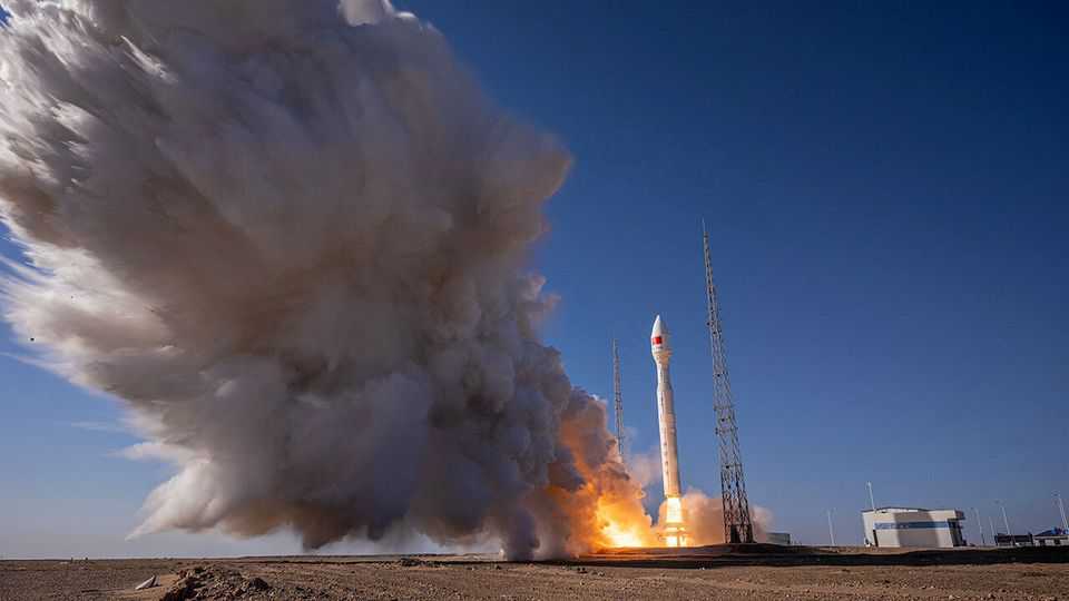
The profusion of Chinese images is a function of the country’s rapidly growing constellations. China launched more than 120 remote-sensing satellites in 2025 alone—a category that includes those that use radar and radio waves, as well as those that use cameras—bringing the total number in orbit to more than 640, second only to America. In America, almost all commercial satellite firms rely on selling images to the armed forces and intelligence agencies; in China, the line between private firms and the state is even blurrier. The single-largest constellation—Jilin-1, comprising over a hundred satellites—is operated by the Chang Guang Satellite Technology (CGST) company, which has close connections to the People’s Liberation Army. Its plan is to be capable of imaging any spot on Earth every ten minutes.
In the race for Earth-observation superiority, Chinese and American commercial satellites are neck-and-neck. Siwei’s Superview Neo-1 satellite offers images every bit as sharp as Vantor, a leading American firm. Aravind Ravichandran, the boss of TerraWatch Space, a market-intelligence firm, says that Chinese commercial satellites “score pretty high” on the most important capabilities. Jilin-1 appears to be ahead of American commercial peers on cadence—the number of times a satellite can revisit an area—largely due to the growing size of its fleet. They are also on par in “forward-looking” technologies, Mr Ravichandran says, like edge computing, which allows data to be processed in space before being beamed back. Things could yet improve further. China is currently leading the world in research impact in several remote-sensing technology areas, according to a commission appointed by Congress to track Chinese activity.
Some companies stress the advantages of working with Chinese firms that sit beyond Western “shutter control”, regulation which restricts what can and cannot be released. “We are not bound by the same export-licence restrictions and bureaucratic delays that can often slow down data acquisition from other vendors,” boasts XRTech Group, a Dubai-based data analytics firm which partners with Siwei.
But Chinese providers have restrictions of their own. “I can say with some confidence that [Chinese firms] are not doing anything that the Communist Party does not want them to do,” says Mike Dahm, who served as senior naval intelligence officer for China at America’s Office of Naval Intelligence. In some cases, the result is greater transparency. Chinese images have helped reveal damage to American military platforms and Gulf energy sites that governments would rather keep under wraps. MizarVision, a company based in Hang-zhou, has published numerous AI-annotated images of American planes and Patriot missile-defence batteries lined up across the Middle East.
MizarVision’s releases also reflect how Chinese firms use AI to squeeze more out of low-resolution images, where it can be harder to make out small objects. It is unclear whether the startup uses images from Chinese satellites or Western ones, although a congressional select committee believes the images were likely to have been taken by Airbus, a European firm. Some of its supposedly AI-generated labels are questionable. But AI can perform two useful tasks, says Mr Dahm. One is the use of computer vision to identify a blurry object, such as a plane, by its shape and size. The other is to track changes over time. One high-resolution photo can show where planes are. Then cheaper and more plentiful low-resolution images can reveal what is going on. “You may not be able to tell what the dots are,” says Mr Dahm, “but each is presumably an aircraft.”
The public release of labelled images by MizarVision may have another benefit, beyond the advertising it provides. As researchers comment on the images, including errors of analysis, that can be used to refine the firm’s models. “They’re providing the training feedback in real time to the algorithms to refine them and make them better,” says Mr Dahm. “Now the engineers can go back and say: ‘That wasn’t a THAAD [air-defence] radar. The THAAD radar actually looks like this, right?’”
This is not the first time Chinese satellite images have helped America’s adversaries. In 2023 America put sanctions on CGST for providing images of Ukraine to the Wagner Group, a Russian mercenary outfit. In April last year the State Department said that CGST had supplied Houthi rebels in Yemen with images that could help target American warships and other vessels in the Red Sea. But sanctions appear to have had limited effects on China’s satellite industry. Spacety, another Chinese firm, just raised $190m from state-linked funds and venture capital, although it too was put under American sanctions three years ago for aiding Wagner.
New capabilities are fast approaching. China has two known commercial constellations which can record video, Jilin-1 and Zhuhai-1; Planet is the only American company with video capability publicly documented. Jilin-1 uses satellite-to-ground laser communications to transfer video from orbit. But Chinese competitiveness does not mean researchers and journalists can easily substitute for the loss of Western images in the Middle East. Some Western researchers told The Economist that they are wary of Chinese providers with potential ties to their country’s armed forces. Others say that Chinese providers ignore them.
Fans of open-source intelligence once hoped that the explosion of satellite imaging would result in greater transparency. It has—for some. “Everyone is building their own Earth-observation systems,” says Mr Greer, pointing to countries in Asia, South America and elsewhere. “But almost all of them are specifically for defence and intelligence,” he laments, “just getting more people spying on each other and less available as a public good.” ■